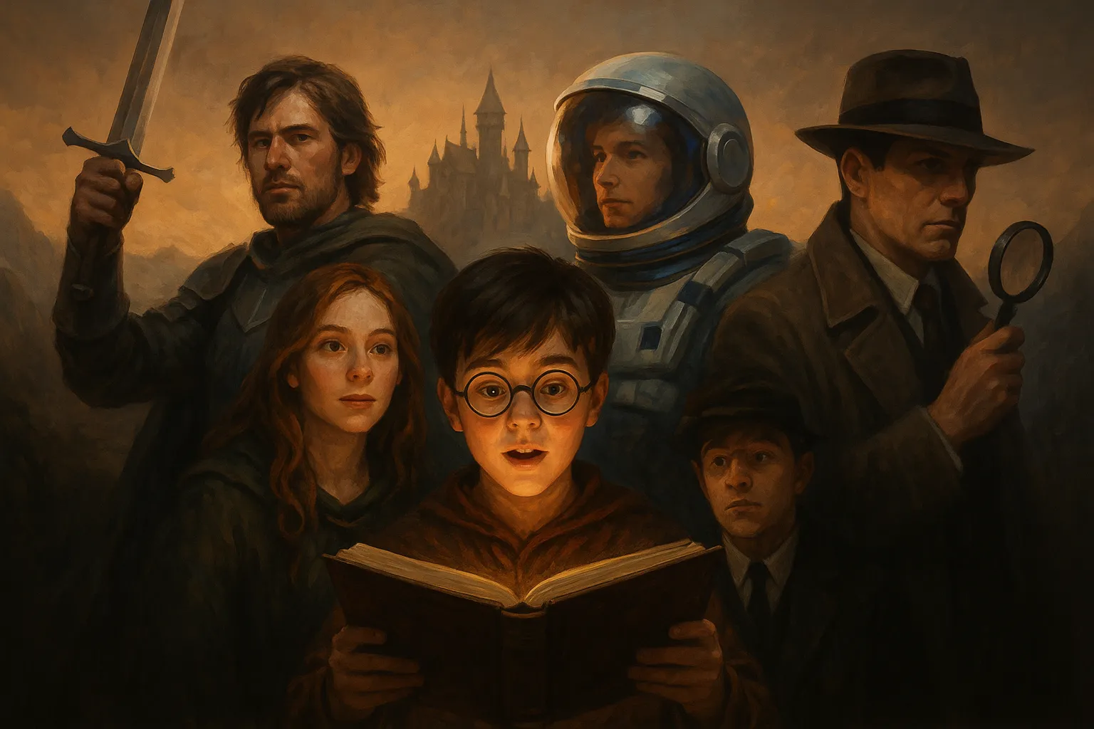
Why Fantasy Scenarios Work So Well
Imagination has always been a powerful tool for human connection. From storytelling around a fire to modern movies and games, people naturally gravitate toward stories that allow them to step outside everyday life. When partners bring that same spirit of imagination into their relationship, it opens the door to new experiences that strengthen trust, communication, and playfulness.
Fantasy scenarios are not about being perfect actors. They are about stepping into a world where rules can bend, characters can change, and stories can unfold in unexpected ways. By creating a safe space where imagination thrives, partners discover fresh layers of connection and a chance to see each other from new perspectives.
The beauty of fantasy scenarios is that they can be adapted to suit any level of comfort. Some may prefer lighthearted, whimsical stories, while others might enjoy dramatic adventures. Either way, the goal is the same: to enjoy the process of building a shared experience where creativity takes the lead.
-
The Adventurer and the Guide
Imagine arriving in a new and unfamiliar land. One partner plays the role of an explorer seeking knowledge, while the other becomes a local guide who knows the hidden paths, secret landmarks, and untold legends of the area. Together, you embark on a journey that could involve discovering ancient ruins, finding treasures, or solving mysteries.
This scenario works well because it naturally encourages curiosity and storytelling. The guide can describe imaginary landscapes and challenges, while the adventurer reacts with questions, discoveries, and decisions. Every conversation adds depth to the journey, making the story unfold like a living novel.
Props can enhance the scene: a simple map drawn on paper, a compass, or even a travel journal. The key is to immerse yourselves in the idea of exploration, embracing both the excitement of the unknown and the comfort of relying on each other.
-
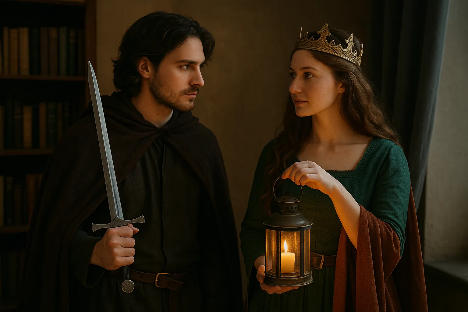
Royalty and the Loyal Protector
Another timeless scenario is stepping into the roles of royalty and protector. One partner plays a ruler — a queen, king, or noble — while the other becomes a loyal knight, guard, or advisor. The story can unfold in many directions: preparing for a royal ball, defending the kingdom from imagined threats, or making important decisions that will shape the realm’s future.
This type of fantasy encourages themes of loyalty, trust, and respect. The royal character may command authority while also relying on the protector’s wisdom, while the protector demonstrates courage and devotion. Together, they create a dynamic filled with drama and intrigue.
The atmosphere can be set with something as simple as a blanket as a cloak or a cup raised like a royal goblet. Adding music inspired by medieval or classical themes helps transport you both into a different time. Even simple dialogue — addressing each other with titles or formal speech — can create a powerful sense of immersion.
-
The Time Travelers
Time travel scenarios allow for unlimited creativity. One partner could take the role of a curious scientist or historian, while the other becomes their companion as they journey into the past or future. Each “stop” in time can open a new chapter: visiting ancient civilizations, witnessing futuristic inventions, or exploring turning points in history.
This scenario works especially well for partners who enjoy learning, as it can be both imaginative and educational. You might find yourselves at a Roman marketplace, aboard a 19th-century steamship, or in a futuristic city of flying cars and artificial intelligence. The joy comes from improvising how your characters react to these environments and what adventures they encounter along the way.
Props like an old-fashioned pocket watch, futuristic-looking sunglasses, or a cardboard “time machine control panel” can add playful details. The focus, however, remains on storytelling: inventing worlds and making discoveries together.
-
The Mysterious Encounter
Everyone loves a good mystery, and roleplay is the perfect stage for suspenseful storytelling. In this scenario, you and your partner pretend to meet as strangers under unusual circumstances. Perhaps one of you plays a detective investigating a case, while the other is a witness holding important information. Or you might both be travelers meeting in a strange town where secrets lie beneath the surface.
The power of this scenario lies in its flexibility. It can be lighthearted or dramatic, filled with clues, puzzles, and shifting identities. You can build tension by asking unexpected questions, dropping hints, or revealing twists as the story unfolds.
Even a simple notebook can become a “case file,” or a candle can serve as a symbol of mystery. Playing with shadows, whispers, and suspenseful dialogue can heighten the atmosphere, turning an ordinary evening into an unforgettable experience.
-
The Teacher and the Student
This scenario focuses on guidance, growth, and learning. One partner takes the role of a knowledgeable mentor — perhaps an artist, historian, or adventurer — while the other becomes an eager student ready to absorb wisdom. The mentor may assign creative tasks, share knowledge about an imaginary subject, or guide the student through a challenge.
This fantasy works well because it is built on themes of curiosity and encouragement. It allows both partners to explore new perspectives — one embracing the role of a leader, the other enjoying discovery and growth. The interaction can be as simple or as elaborate as you wish, ranging from lessons about ancient myths to imaginative skills like “dragon riding” or “space navigation.”
Props like books, chalkboards, or sketchpads can enhance the experience. What matters most is the spirit of learning and the playful exchange of ideas. Over time, the student may even surpass the teacher, creating a natural twist in the storyline.
How to Begin Exploring These Scenarios
Trying out fantasy scenarios for the first time can feel like stepping onto a stage without a script. The best way to begin is to start small. Pick one of the scenarios above and try it for just a short scene. Don’t worry about perfection — allow improvisation to guide the interaction.
You can also rotate roles, letting each partner experience different perspectives. For example, one day you may be the adventurer and the next, the guide. This keeps the activity fresh and ensures that both of you get to enjoy different sides of the story.
The important thing is to approach these scenarios with openness and curiosity. Even if the first attempt feels lighthearted or awkward, it sets the foundation for deeper and more imaginative experiences later.
Building Confidence Through Practice
The more you engage in these scenarios, the easier it becomes to slip into character and enjoy the experience. Over time, you may begin to expand on the storylines, revisit favorite characters, or combine elements from different scenarios to create unique adventures.
Confidence comes naturally when you realize there are no rules or limitations. Every detail, from the way you speak to the way you describe the environment, adds to the shared world you are building. By embracing creativity and encouraging each other, you turn each roleplay into a celebration of imagination and partnership.
Taking Scenarios Beyond the First Session
After trying out a fantasy scenario once, many partners find that they want to revisit it and see how the story might continue. Instead of starting fresh each time, you can expand a single idea into a series of connected sessions. For example, if you began with the “Adventurer and Guide” theme, you might return to the same imaginary world later and discover new locations, challenges, or characters. This sense of continuity transforms roleplay into an unfolding journey, almost like watching a series where each new episode builds upon the last.
Ongoing stories allow characters to grow. The adventurer may gain confidence over time, or the guide may reveal hidden layers of their past. Similarly, a royal and protector might face political challenges one week and prepare for celebrations the next. With each new layer, the experience deepens and becomes more immersive. This ongoing format also builds anticipation, giving both partners something fun and imaginative to look forward to together.
Adding Layers of Detail
Once you’re comfortable with the basic scenarios, you can enrich them by layering in small details that bring them to life. Details can be as simple as giving your character a unique quirk, such as a particular way of speaking, or as complex as inventing backstories and motives. The more texture you add, the more believable and entertaining the interaction becomes.
For instance, in the “Time Travelers” scenario, you could create a recurring challenge — perhaps the time machine malfunctions at inconvenient moments, forcing the characters to adapt. In the “Mysterious Encounter,” the storyline could introduce clues that point toward a larger secret. These added elements don’t have to be complicated; even small twists can make the story engaging and unpredictable.
Another way to add depth is through world-building. Describe the environment in vivid detail: the smell of the market, the sound of distant bells, the flickering lanterns of a forgotten alley. Sensory details help immerse you both into the world you’re imagining, making it easier to stay in character and feel part of the story.
Rotating Roles for Fresh Perspectives
While you may start with one set of roles, switching positions later can add variety and freshness. If you began as the adventurer, try taking on the role of the guide in a future session. This shift allows you to see the scenario from a different perspective and challenges you to explore new creative angles.
Rotating roles also keeps the experience balanced. Each partner has the opportunity to lead the story at times and to follow at others. This creates a dynamic exchange of ideas and ensures that both voices shape the unfolding narrative. For example, in the “Teacher and Student” scenario, the student may eventually become the teacher, flipping the structure and sparking new layers of creativity.
Incorporating Atmosphere and Props
Atmosphere plays a huge role in making fantasy scenarios memorable. You don’t need elaborate equipment or costumes to create it — small adjustments can set the stage effectively. Lighting, background music, or even rearranging furniture can change the feeling of the space.
If you’re playing out the “Royalty and Protector” theme, soft instrumental music and a dimly lit room can create a sense of grandeur. For a “Time Travelers” story, futuristic sound effects or glowing lights can set the tone. Props don’t have to be expensive; everyday objects can be transformed with a little imagination. A book becomes an ancient spell manual, a mug becomes a royal chalice, and a scarf becomes a traveler’s cloak. These touches enhance immersion without requiring much preparation.
The key is to create an environment that encourages both of you to let go of daily routines and step fully into the shared story. By surrounding yourselves with even minimal cues, it becomes easier to suspend disbelief and embrace the experience wholeheartedly.
Overcoming Awkwardness Together
It’s natural to feel a little awkward when trying something new, especially if you’re not used to improvising. The best way to handle this is to treat mistakes or stumbles with humor. Laughing together not only eases tension but also strengthens your connection. Roleplay doesn’t need to be taken too seriously — it’s about enjoying the creativity and the time spent together.
Another useful tip is to prepare a few prompts or “starter lines” beforehand. If you worry about not knowing what to say, think of one or two phrases your character might use to set the scene. Once the conversation starts, ideas usually flow more easily than expected. With each attempt, confidence grows, and before long, slipping into character will feel completely natural.
Exploring Hybrid Scenarios
Once you’ve tried the five main fantasy scenarios, you can begin blending them into hybrids. Imagine combining the “Time Travelers” with the “Mysterious Encounter,” where your characters meet strangers in different eras. Or merge “Royalty and Protector” with “Adventurer and Guide,” where your characters leave the safety of the palace to explore a dangerous new land.
Hybrid scenarios add unpredictability and can make each experience feel unique. By mixing elements, you avoid repetition and keep the storytelling fresh. These mash-ups also encourage both partners to collaborate creatively, as the storyline may take unexpected turns that neither of you had planned.
Making Fantasy a Shared Tradition
As you continue experimenting, roleplay may evolve into more than just an occasional activity. It can become a shared tradition that enriches your relationship. Setting aside time for it — perhaps once a week or once a month — turns it into a ritual you both anticipate.
These traditions create shared memories that are different from everyday life. Instead of simply recalling a dinner out or a trip, you’ll also remember the time you played explorers discovering hidden caves or detectives unraveling a case. Such moments stand out precisely because they were created through imagination and collaboration.
Over time, these shared experiences build a kind of private mythology between you. The characters, worlds, and stories you invent become part of your unique connection, something that belongs only to the two of you.
Drawing Inspiration from Everyday Life
If you ever run out of ideas, inspiration is all around you. A conversation overheard at a café, a headline in the news, or even a walk through a historic building can spark a new scenario. Everyday life is filled with moments that can be transformed into imaginative stories with just a little creativity.
Books, films, and games are also excellent sources of inspiration. You don’t need to copy them directly — instead, let them influence the tone or setting of your own scenarios. Perhaps a film about explorers inspires your next adventure, or a historical drama sparks the idea for a royal banquet. By drawing from multiple sources, you keep your roleplay evolving and full of variety.
Why Fantasy Scenarios Strengthen Bonds
At their heart, fantasy scenarios are more than playful games. They are opportunities to build trust, explore creativity, and share laughter. By imagining new worlds together, you learn more about each other’s interests, preferences, and styles of expression. You also create memories that are distinct from daily life, memories that highlight your ability to dream and play as a team.
This shared creativity can strengthen communication and deepen understanding. It teaches patience, adaptability, and the joy of co-creating something unique. The more often you engage, the more you discover about each other’s imagination and ability to collaborate, which only strengthens the bond you share.
Continuing the Adventure
There are countless ways to adapt and expand fantasy scenarios. Whether you prefer grand adventures, lighthearted encounters, or mysterious puzzles, the important thing is to keep the spirit of play alive. Each session offers a new opportunity to step outside routine and see your partner in a different light.
The journey of roleplay is never truly finished. Every time you pick up a scenario, it can evolve into something unexpected, creating fresh stories and memories. By embracing creativity, encouraging each other, and allowing imagination to guide the way, you ensure that the adventure continues, always full of possibilities waiting to be explored.